


Scattered storms are moving out of North Iowa Thursday morning after reports of an inch of rain fell in Mason City, but there is more to be had through the day.


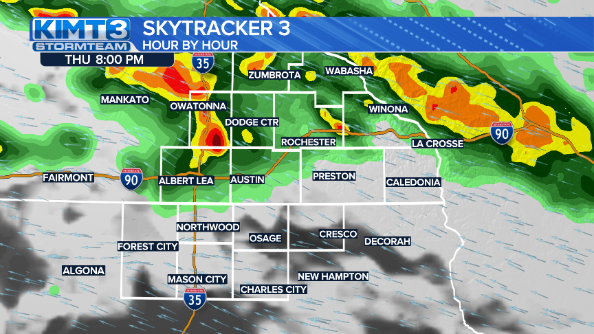
After a break from storms during the middle of the day, more are likely to pop back up later this afternoon/evening. These storms likely begin sometime after 4pm and grow stronger/larger in the hours following. They will be rather scattered, so not everyone will see these storms. That being said, Southern Minnesota seems a bit more likely to see storms later Thursday than North Iowa.
Temps warm into Friday afternoon with mostly cloudy skies and high temps near 60 degrees. This turns into more scattered storm activity as early as Friday night, with storms and showers continuing on/off all Saturday and even into times Sunday morning.


